[Arctic Maritime Strategy] Sovereignty, Navigation Rights and Great-Power Rivalry in the Bering Strait

Working across research, policy, and data-driven analysis, the Editorial Board ensures that published pieces reflect a consistent institutional perspective grounded in quantitative reasoning and long-term structural assessment.
Authored On
Modified
Every Bering Strait transit crosses U.S. or Russian territorial sea
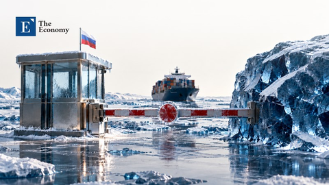
Transit passage means neither state can legally close it
Unratified 1990 boundary and research rules remain the weak points
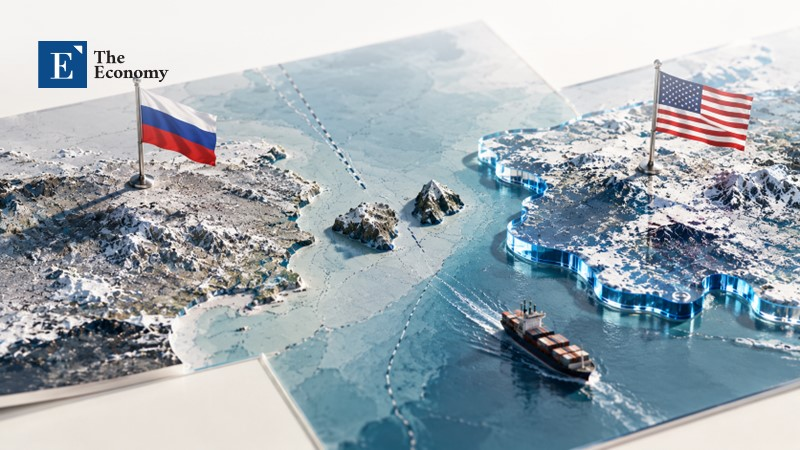
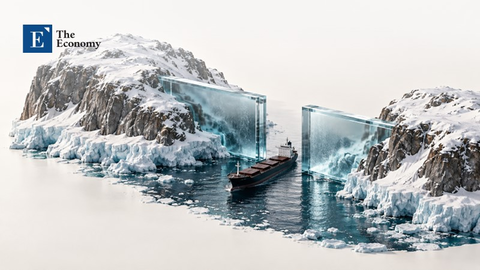
The Russian and U.S. flags fly approximately 2 nautical miles apart between the two Diomede Islands. On each side of the Diomedes, the Bering Strait widens to approximately 22 nautical miles. This is less than the 24 nautical miles that two 12-mile territorial seas would occupy if they didn't touch. Therefore, there is no high seas or EEZ that runs through the middle of the Bering Strait. All 665 ships that transited through the Bering Strait, as reported by the Marine Exchange of Alaska in 2024 traveled through water that belongs to either the US or Russia. That is close to three times the 242 that passed through in 2010. No country that owns water in the Bering Strait can shut it down. These boundaries were created with the expectation that there would be two competing countries. Alaska Purchase, a Boundary Agreement of 1990 that has yet to be officially ratified, and the United Nations Convention on the Law of the Sea that the U.S. has not ratified are all being tested by Chinese Icebreakers and Russian Submarines. The question of how these agreements will withstand the test of 3 competing nations can be answered by breaking down ownership of the land and islands from water jurisdiction and freedom of navigation.
What the 1867 Alaska Purchase Conveyed
On the 30th of March 1867, the Treaty of Cession was signed by Secretary of State William Seward and the Russian envoy Edouard de Stoeckl. The United States bought all of the land and dominions Russia possessed in the American continent and the surrounding islands for 7.2 million dollars. That's about two cents an acre for nearly 600,000 square miles. In Article I they established a very specific western border. The line begins in Bering's Strait at 65 degrees 30 minutes north on the meridian which runs through the center of Krusenstern or Ignalook and Ratmanoff or Noonarbook (now called Little and Big Diomede). Then it goes "without limitation" North through what was then called the Frozen Ocean. Another line was created going southwest between St. Lawrence Island and the Chukotka Peninsula. Bending towards the 193rd Meridian West. All Aleutian Islands east of that line were owned by the United States.
This created a line of land and islands. The ocean around a coastal state only extended out 3 miles. There was no concept of an Exclusive Economic Zone and no expectation that this line would create a boundary that extended hundreds of miles out into the ocean. So it simply divided up the land and islands. This would cause issues in the future when both countries extended their claims out to the 200-nautical-mile Exclusive Economic Zone. The boundary could be interpreted as a rhumb line on a Mercator projection map. Or as a great-circle distance on the Earth. A wedge of the Bering Sea fell in between those two lines and was claimed by both.
Many current articles ignore this distinction and act like the United States owns half of the Bering Strait because of the Alaska Purchase. The United States does own Little Diomede and the Seward Peninsula. And the water around them is U.S. Territorial Sea. That gives Washington sovereignty over the water, the seabed underneath it and the airspace above it, subject to passage rights. But those rights come from the modern Law of the Sea, not from the Alaska Purchase. "Without limitation" doesn't apply to the Law of the Sea. The 1990 Boundary Agreement only takes that line North as far as International Law will allow. This eliminated any chance that the Alaska Purchase could be used to justify an Arctic sector. Russia's continental shelf submission to the United Nations is not based on the Alaska Purchase but rather the geography of the ocean floor.
A 1990 Boundary That Works Without Entering Into Force
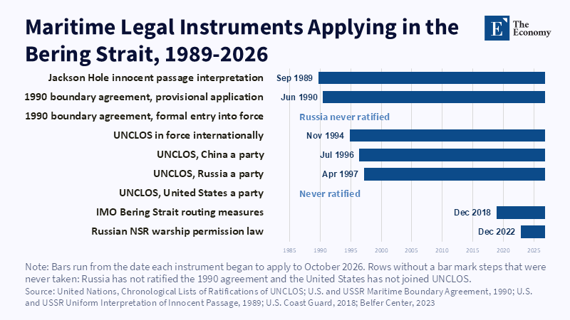
Secretary of State James Baker and Soviet Foreign Minister Eduard Shevardnadze signed the Boundary Agreement on June 1st, 1990. They used the Western line from the Alaska Purchase as the boundary. They set the starting point at 65 degrees 30 minutes North, 168 degrees 58 minutes 37 seconds West. The Boundary Agreement will come into force when ratification documents are exchanged. The United States Senate voted to approve the agreement on the 16th of September 1991. The Soviet Union collapsed three months later and the Russian Duma has never ratified the agreement. But both governments did sign an agreement on that same day to apply the boundary from June 15th 1990 until it is ratified.
Article 3 is where it gets interesting. Russia agreed that if there is water East of the Boundary line that falls within 200 nautical miles of Soviet Borders, but outside of 200 nautical miles from U.S. Borders. Then the United States will have EEZ rights in that area. The US did this for one area of the West as well. They also stated that these EEZ rights would not expand either country's Exclusive Economic Zone. President George H.W. Bush mentioned that it would divide continental shelf jurisdiction in the Arctic Ocean and the Bering and Chukchi Seas in his letter to the Senate. Russian critics have long claimed that Shevardnadze gave away too much. In February 2024 a Russian Duma member asked Foreign Minister Sergey Lavrov whether Russia should end its boundary agreements with Norway and the United States.
Some in Alaska have made resolutions arguing that the Boundary Agreement doesn't count because it has not been ratified. The Russians make this argument as well. But there is a provision in Article 25 of the Vienna Convention on the Law of Treaties that allows provisional application of a treaty. Foreign Minister Lavrov stated that the Boundary Agreement is in force by agreement and is being fully implemented. This allows Russia to make a continental shelf claim without the United States objecting. The United States is using the same logic. When the Coast Guard announced that a Chinese icebreaker traveled through the "U.S. extended continental shelf in the Bering Sea." They are using the 1990 Boundary Agreement to claim the ocean floor under that water. The one weakness in this argument is also found in Article 25. A state can notify the other state that it does not wish to ratify the treaty and end provisional application. At that point there is no arbitrator to decide who owns that boundary.
Bering Strait Navigation Rights Under the Law of the Sea
There are 3 areas that have different sets of rights in and around the Bering Strait. Inside the Narrows, the water is classified as Territorial Sea, which gives the coastal state ownership over it, with the exception of shipping. Outside of the Narrows, the water is considered an Exclusive Economic Zone up until the Boundary Line. Both sides of the strait have EEZ rights over that water. All other countries have freedom of navigation and flight. Outside of both Exclusive Economic Zones in the Bering Sea is what is commonly known as the Donut Hole. This is the high seas. There is no disagreement on this. It comes from the United Nations Convention on the Law of the Sea from 1982, which Russia and China have ratified. And the United States considers it to be Customary Law. At least as far as navigation goes.
The debate lies in what the strait regime allows. There are straits used for international navigation that are subject to transit passage. According to an article written for the Russian International Affairs Council, both the US and Russia consider the Bering Strait to be a strait used for international navigation. This allows for all ships to pass through, including military ships, which can travel underwater. It cannot be stopped under Article 44 whether a non-signatory to the Law of the Sea can claim this as customary law. And whether traveling underwater is allowed. And whether Article 234 can be applied to a strait that is under transit passage are all areas that are still in dispute. China has not accepted transit passage as customary law. That position would deny U.S. warships the footing Chinese research ships enjoy as treaty parties when they travel North past Little Diomede.
Both countries have worked together to fill in some of the gray areas. In 1988 Soviet Ships bumped into the USS Yorktown and USS Caron while traveling through the Black Sea. After this incident, the U.S. and the Soviet Union signed the Jackson Hole Uniform Interpretation in 1989. It states that all ships will have the right of innocent passage through Territorial Waters. This includes military ships. And that they don't have to notify the coastal state or get authorization. In 2018, they jointly proposed 6 two-way routes that go through the Bering Sea and Strait. These routes and precautionary areas have been in effect since December 1st 2018. The routes are voluntary for all ships. Russia recently passed a law in December of 2022. That requires foreign warships to request permission 90 days before they enter internal waters. This only applies to the internal waters of the Northern Sea Route, which ends at the Latitude of Cape Dezhnev. This is on the North side of the Bering Strait.
What Chinese and Russian Ships May Do in the Bering Strait
A ship traveling through another state's Exclusive Economic Zone is not breaking any laws. The U.S. Coast Guard has acknowledged this as well. When a Chinese icebreaker passed through the U.S. EEZ and extended continental shelf. The Coast Guard said that they were allowed to do this. But if they were doing research in that area they would need advance permission from the United States. And share their data. So what they are doing in that area is what creates an issue. In 2025 China had five research ships operating in Arctic waters near Alaska. U.S. Northern Command said. As of September 2026, there have been four that the Coast Guard has tracked. They have traveled around the Aleutians. Through the Bering Strait and up to the North Pole. Article 40 of the Law of the Sea says that research and survey ships cannot conduct research and surveys while using the right of transit passage. If a Chinese research ship is traveling through the Bering Strait, it cannot turn on its multibeam sonar to map the ocean floor without prior authorization.
When a Coast Guard Ship or Military Ship travels through another state's EEZ, it is using its right of navigation. On the 28th of September 2024 two China Coast Guard Ships were traveling with two Russian Border Guard ships. They were about 5 miles inside the Russian Exclusive Economic Zone. China stated that its Coast Guard was traveling through the Arctic Ocean for the first time. While this may have sent a message. It wasn't breaking any laws. It was happening in Russian waters with Russian permission. Thirteen days before that the USCGC Stratton observed four Russian military ships cross the border into the U.S. Exclusive Economic Zone. About 57 miles northwest of Point Hope. Two of which were submarines. The United States has been defending the right to travel through another country's EEZ in the South China Sea. Gathering intelligence is another gray area. The United States believes it can gather intelligence outside of the Territorial Sea. China believes that they need permission to conduct any military activity in its EEZ. The United States can't tell China that it can't gather intelligence around Alaska because its ships are gathering intelligence around China.
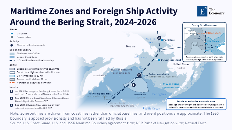
A coastal state can only restrict foreign ships in its own Territorial Sea. It can temporarily suspend innocent passage in certain areas as long as it's necessary for security. It must publish it in the same way to all countries. It can also require that a military ship leave its waters if it ignores the coastal state's rules. No state can stop a country from using the right of transit passage in the Bering Strait. Rules can be created through the International Maritime Organization. That doesn't hinder the right of transit passage. Fishing can be policed in the EEZ and action can be taken against the Flag State if its ships cause harm. There is no way that the United States or Russia can legally stop each other's military or China's Research Ships from using the Bering Strait at least in a time of peace. What would happen if there were an armed conflict is unknown.
Why Rivals Keep the Bering Strait Open
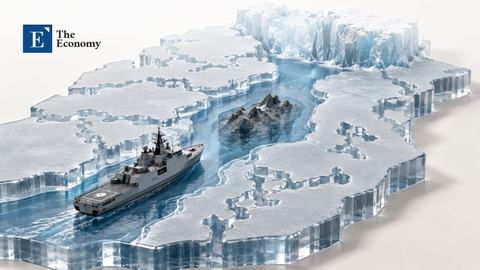
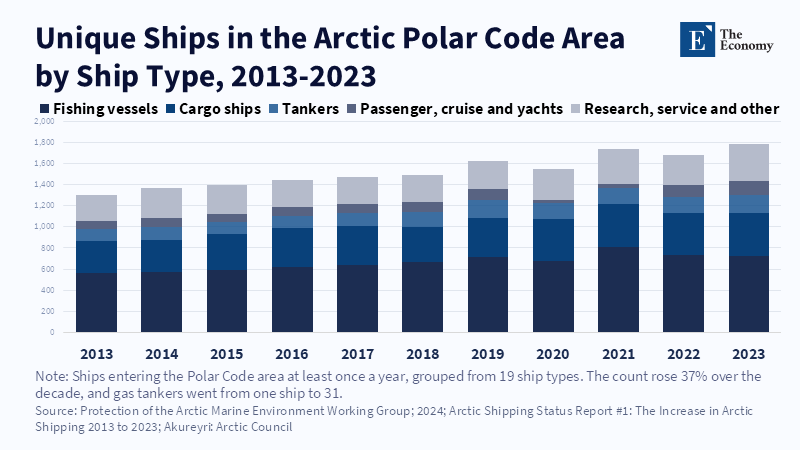
There is a lot of commerce that happens in the Bering Strait, which both countries want to keep open. The largest share of ships traveling through the Russian side of the Bering Strait in 2024 were tankers. Many carry Russian LNG to Asia. On the U.S. side the largest share were tugs and towing vessels, according to the Alaska Beacon. Most of these ships are traveling through the six routes that were created in 2018. If a ship were to run aground or cause an accident in the Bering Strait. It would shut the strait down. Whatever the law says. Russia also needs the Bering Strait to move military ships between its Pacific and Northern Fleets. The U.S. needs to be able to use the Strait of Hormuz and Gibraltar. Both of which are under the same transit passage that applies to the Bering Strait.
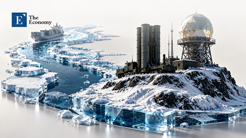
There will be growing tensions as Russia and the United States continue to work together less. The other Arctic states paused most cooperation with Russia in the Arctic Council and the Arctic Coast Guard Forum after 2022. Duma members are challenging the U.S. boundary with Russia. And China is sending more research ships to the Arctic. The United States Department of State and Coast Guard will need to continue to push the line. By stating that each time a Chinese ship passes through U.S. waters, the passage is lawful. But research there requires U.S. permission. And continue to protect U.S. agreements with Russia on things like search and rescue and Oil spills. These will be important if there is an emergency. Russia also doesn't want to end the provisional application. They are using the Boundary Agreement to claim a piece of the Arctic.
The Diomede Islands are 2 nautical miles apart. They share a boundary that either the United States or Russia could end with one notification. The Law of the Sea will answer many of these questions. Some will have a clear answer and others will not. Transit passage cannot be stopped. And a country conducting research in the U.S. EEZ needs U.S. permission. Where it gets tricky is if that research is a hydrographic survey. Or a Military Survey. If a Chinese icebreaker is mapping the U.S. extended continental shelf. They can call it a survey or research. The U.S. Coast Guard will have to act accordingly. It remains to be seen whether Russia or China take issue with U.S. research ships doing the same thing in their waters.
The views expressed in this article are those of the author(s) and do not necessarily reflect the official position of The Economy or its affiliates.
References
Associated Press (2024) ‘Chinese and Russian coast guard ships sail through the Bering Sea together, US says’, Associated Press, 1 October.
Edvardsen, Astri and Hansen, Birgitte Annie (2024) ‘Lavrov Stands Firm on Maritime Border Agreements With Norway and the US’, High North News, 19 February.
Gudev, Pavel (2015) ‘Conflicting Interests in Regulating Navigation in the Bering Strait’, Russian International Affairs Council, 8 October.
Ham, Walter (2018) ‘IMO approves U.S.-Russian proposal for Bering Strait routing measures’, U.S. Coast Guard Headquarters, 25 May.
Rosen, Yereth (2025) ‘Ship traffic in strait between Alaska and Russia shows adherence to new safety standards’, Alaska Beacon, 13 August.
Russia and United States of America (1867) Treaty Concerning the Cession of the Russian Possessions in North America. Washington, 30 March.
The Watch (2026) ‘U.S. watches Chinese research vessels off Alaska’, The Watch, 20 October.
Todorov, Andrey (2023) ‘New Russian Law on Northern Sea Route Navigation: Gathering Arctic Storm or Tempest in a Teapot?’, Belfer Center for Science and International Affairs, Harvard Kennedy School, 9 March.
United Nations (1969) Vienna Convention on the Law of Treaties. Vienna, 23 May.
United Nations (1982) United Nations Convention on the Law of the Sea. Montego Bay, 10 December.
United States Coast Guard (2024) ‘U.S. Coast Guard encounters Russian naval vessels near Point Hope, Alaska’, press release, 16 September.
United States Coast Guard (2026) ‘Coast Guard Secures the U.S. Arctic as Chinese Research Vessels Arrive in the Bering Sea’, press release, 17 July.
United States of America and Union of Soviet Socialist Republics (1989) Uniform Interpretation of Rules of International Law Governing Innocent Passage. Jackson Hole, 23 September.
United States of America and Union of Soviet Socialist Republics (1990) Agreement on the Maritime Boundary, with Exchange of Notes on Provisional Application. Washington, 1 June.
Working across research, policy, and data-driven analysis, the Editorial Board ensures that published pieces reflect a consistent institutional perspective grounded in quantitative reasoning and long-term structural assessment.